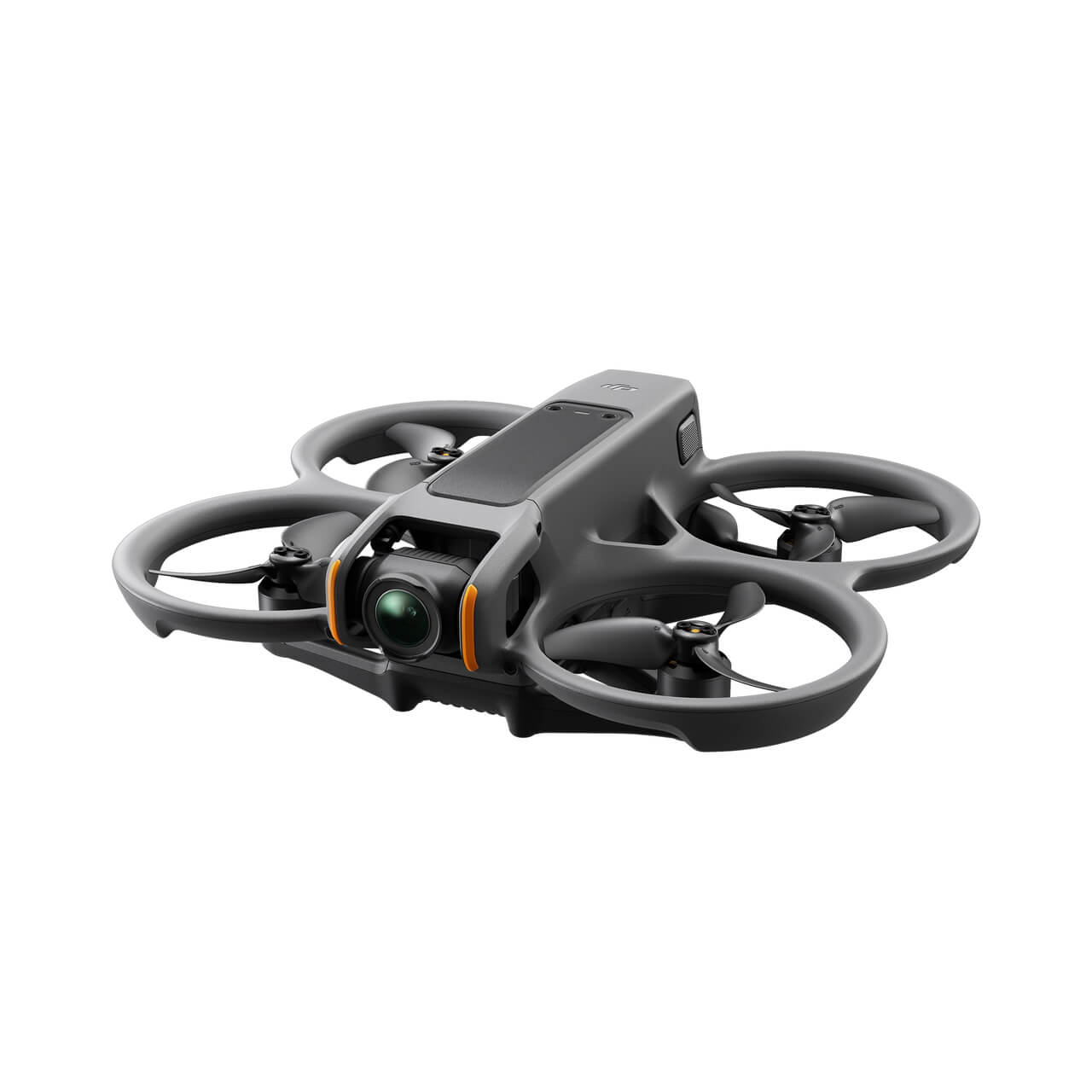
In the evolving landscape of technology, drones have emerged as pivotal tools for public safety. Their aerial vantage point, coupled with high-tech features, provides first responders with invaluable insights during emergencies.
Here are some of the top public safety drones that are making a difference:
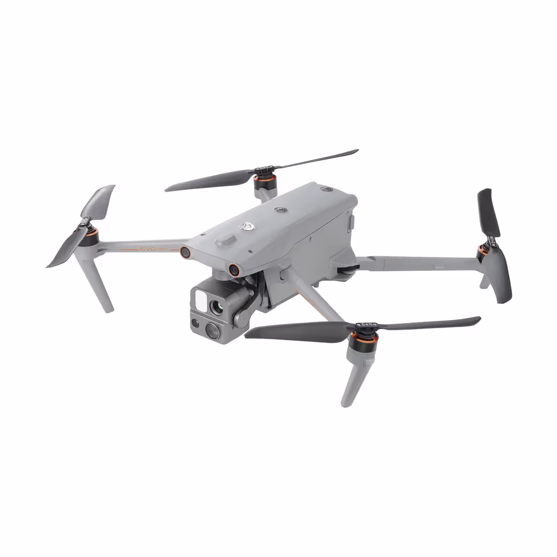
Durability and Weather Resistance: Withstands extreme temperatures (-20°C to 50° C) and has an IP55 rating for protection against rain and sand.
Advanced Remote Control (DJI RC Plus): Offers improved ergonomics, a large screen, physical buttons, and supports Advanced Dual Control for two-pilot operation.
Enhanced Transmission System: The OcuSync 3 Enterprise Transmission system provides stable connections and triple-channel 1080p video transmission, with a range of up to 20 kilometers.
Arm Locking Safety Mechanism: Features a magnet in the arm lock to detect secure installation, preventing takeoff if not correctly installed.
Low-light FPV Camera: Shares components with the M30, enhancing performance in low-light conditions for nighttime operations.
Payload Compatibility: Compatible with all M300 payloads and supports integration with third-party payloads via the DJI Payload SDK.
Efficient Transport Design: A redesigned protective case with 360-degree wheels for easier transportation.
Optimized Battery System: Includes a redesigned charging station and TB65 batteries offering up to 55 minutes of flight time, hot-swappable, and approximately 400 charge cycles.
Applications:
Public Safety: Suitable for search and rescue operations, law enforcement, and emergency response.
Inspection and Mapping: Supports advanced mapping capabilities and can be used for infrastructure inspection, geological surveying, and environmental monitoring.
Air-to-Ground Coordination: Features like high-precision PinPoint and real-time mapping enable effective coordination between aerial and ground operations.
Automated and Precision Inspection: Capable of storing flight routes for repetitive inspections and supports AI Spot-Check for improved accuracy in inspection operations
Advanced Flight Safety: Equipped with six-way obstacle avoidance sensors and real-time health management system. Capable of emergency landing with three functioning props.
Portability: Weighs only 3.77 kg, foldable for easy transportation.
High-Quality Imaging: Includes a 48 MP Zoom camera, 12 MP Wide camera, and a laser rangefinder, capable of 4K recording. The Matrice 30T variant adds a thermal sensor for precise temperature measurements.
Impressive Flight Performance: Offers a 41-minute flight time, over 50 mph top speed, and stability in strong gusts.
Rapid Deployment: Designed for quick setup with foldable arms and quick-lock system, requiring no calibration before takeoff.
Environmental Durability: IP55 rating for resistance to light rain and extreme temperatures (-20°C to 50°C).
Sophisticated Control System: Features the DJI RC Plus controller with a 7-inch screen, IP54 weatherproofing, and physical buttons for critical functions.
Advanced Battery Charging System: Three charging modes including a ready-to-fly mode for quick charging.
Integration with DJI Enterprise Ecosystem: Compatible with DJI Dock and DJI Flighthub 2 for enhanced mission coordination and management.
Applications:
Public Safety and Emergency Response: Ideal for rapid deployment in emergency scenarios.
Infrastructure and Equipment Inspections: High-quality imaging and portability make it suitable for inspecting hard-to-reach areas.
Surveillance and Monitoring: Effective for monitoring large areas, especially in low-light or challenging environmental conditions.
Search and Rescue Operations: The drone's extended flight time and robust imaging capabilities are crucial for search and rescue missions.
Environmental Research: Can operate in various weather conditions, making it suitable for environmental studies.
Law Enforcement: Useful for surveillance and situational awareness in law enforcement operations.
Firefighting Support: Can provide critical information in firefighting scenarios, especially with its thermal imaging capabilities.
Disaster Management: Can be rapidly deployed for disaster assessment and management efforts.
Portable Design: Weighs about 500 grams and has a foldable design, making it easy to transport in its waterproof case.
Advanced Imaging System: Equipped with a FLIR Boson thermal camera, a 32x zoom RGB camera, and a wide-angle RGB camera, supporting 4K video recording and thermal imaging.
Cyber-Secure System: Features advanced data encryption, secure WPA2 Wi-Fi connection, and compliance with the European Union General Data Protection Regulation (GDPR).
Autonomous Flight Capabilities: Supports automatic flights, satellite navigation (GPS, GLONASS, GALILEO) coordinates, and target-tracking, with a Return To Home (RTH) feature.
Variety of Sensors: Includes a barometer, magnetometer, ultra-sonar, vertical camera, and dual 6-axis IMU (inertial measurement unit).
Minimal Flight Noise: Designed for discreet operations with minimal noise disturbance.
Impressive Flight Time: Offers up to 32 minutes of flight time.
IP53 Certification: Dust and water-resistant, suitable for various weather conditions.
Smart Controller: The Parrot Skycontroller USA features an 8-inch touchscreen with an IP53 rating and over 3 miles of transmission range.
Robust Software Ecosystem: Compatible with Pix4Dreact and other software, with an open-source SDK for further application development.
Applications:
Search and Rescue Operations: Ideal for rapid response and locating individuals in emergencies, with capabilities to identify detailed locations from up to 5 km away.
Law Enforcement: Suitable for surveillance and evidence collection, with a low noise level for discretion, and quick deployment capabilities.
Military Operations: Offers situational awareness and operational intelligence, with a compact and discreet design suitable for confidential missions.
Public Safety and Inspections: Can be used for public safety operations and various inspection tasks, with compatibility with different mapping and analysis software
Parrot ANAFI USA drone is a Blue UAS-listed, NDAA-compliant aircraft. This compliance ensures it meets specific standards for government and military use, particularly in the United States, aligning with the requirements of the National Defense Authorization Act (NDAA). Being listed as a Blue UAS indicates its suitability for secure and sensitive operations by U.S. government agencies and the military.
Tilt-Rotor Design: Simplifies operation and maximizes performance and efficiency. It’s modular, waterproof, smart, and reliable.
Extended Endurance: Up to 158 minutes of flight time with payload, significantly ahead of its competition.
Quick Assembly: Can be assembled and mission-ready in about 3 minutes.
High Optical Zoom and Speed: Supports 4K 50x optical zoom and has a maximum speed of 108km/h.
Long Transmission Range: Capable of an 18.6-mile transmission range.
Safety and Redundancy: Composite outer shell and carbon fiber core for wind resistance and IP43 weather resistance. It has backup modules for key components like battery, barometer, positioning system, compass, and IMU, ensuring flight safety.
Intelligent and Autonomous Operation: Includes advanced flight control technology, AI High-Speed Tracking, Terrain Follow, and other automated functions.
RTK Accuracy: Two RTK modules for centimeter-accurate location data, which also improve image metadata quality and flight precision.
Interchangeable Payload System: Allows for a variety of payload options to suit different mission needs.
Ground Control Station: Features a 9.7" 1000nit ultra-bright touchscreen with Samsung EXYNOS eight-core processor and ultra HD resolution.
Compact and Portable: Easily disassembled and fits into the trunk of an average-sized car, ready to fly in less than 5 minutes.
Applications:
Public Safety: Suitable for various public safety operations due to its advanced features and flexible payload options.
Fire Fighting & Prevention: Its extended flight time and high-resolution imaging capabilities make it ideal for firefighting and prevention tasks.
Energy: Can be used for monitoring and managing energy infrastructure like power lines and wind turbines.
Traffic Monitoring & Management: Useful for traffic surveillance, congestion analysis, and accident response.
Coastal Overwatch & Security: Ideal for coastal surveillance and security operations due to its extended range and high-resolution imaging.
Agriculture: Applicable for agricultural monitoring, crop health assessment, and precision farming techniques
Conclusion:
The significance of drones in public safety cannot be overstated. These devices have revolutionized the way first responders approach emergencies, offering real-time, aerial perspectives that can be life-saving. With technological advancements, drones like these will continue to be an indispensable tool in public safety operations around the world.
FAQs about Public Safety Drones
What makes a drone suitable for public safety operations?
Drones suitable for public safety operations often possess longer flight times, advanced sensing capabilities for obstacle detection, high-resolution cameras, and often thermal imaging. Durability in various weather conditions and extended communication ranges are also essential features.
How do public safety drones differ from recreational drones?
Public safety drones are typically more advanced than recreational drones. They come with enhanced features like thermal imaging, extended battery life, and multiple payload capabilities. Additionally, they often meet specific regulatory and safety standards, ensuring they can operate reliably during critical missions.
Is special training required to operate these drones for public safety?
Yes, operators flying drones for public safety often undergo specialized training. This training ensures that they can handle emergency situations, understand the technical aspects of their drones, and can make quick decisions during high-stakes operations.
How do drones enhance the efficiency of search and rescue operations?
Drones provide an aerial view, allowing search and rescue teams to cover vast areas in shorter times. Features like thermal imaging can detect heat signatures, making it easier to find lost or stranded individuals, especially in low-visibility conditions. Drones can also access areas that may be challenging or dangerous for human teams.
Are there any privacy concerns associated with using drones in public safety?
Yes, privacy concerns can arise when drones are used for surveillance or crowd monitoring. It's essential that departments using drones adhere to local, state, and federal regulations and guidelines. Transparent communication with the public about when and why drones are being used can also help address these concerns.
By clicking “Accept All Cookies”, you agree to the storing of cookies on your device to enhance site navigation, analyze site usage, and assist in our marketing efforts. View our Privacy Policy for more information.


.jpg)